Purchase Memberships and Products
Shipping rolled maps or shipping products overseas will incur an additional fee.
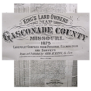
1875 Map of Gasconade County
1875 Map of Gasconade County
$15.00
1875 Map of Gasconade County
This map is a reduced reproduction of Ogle’s original, showing all tracts of land in the county (outside of towns) identified by landowners, complete with index of landowners arranged by political township. Paper, index, shipped rolled.
Publisher: Gasconade County Historical Society
Dimensions: 32.5 x 35.5
Quantity: